About All Tours To Machu Picchu Tours4-Day Tours5-Day Tours3-Day Tours2-Day ToursPremium Tours Directions Hours & Fees
Find Tours 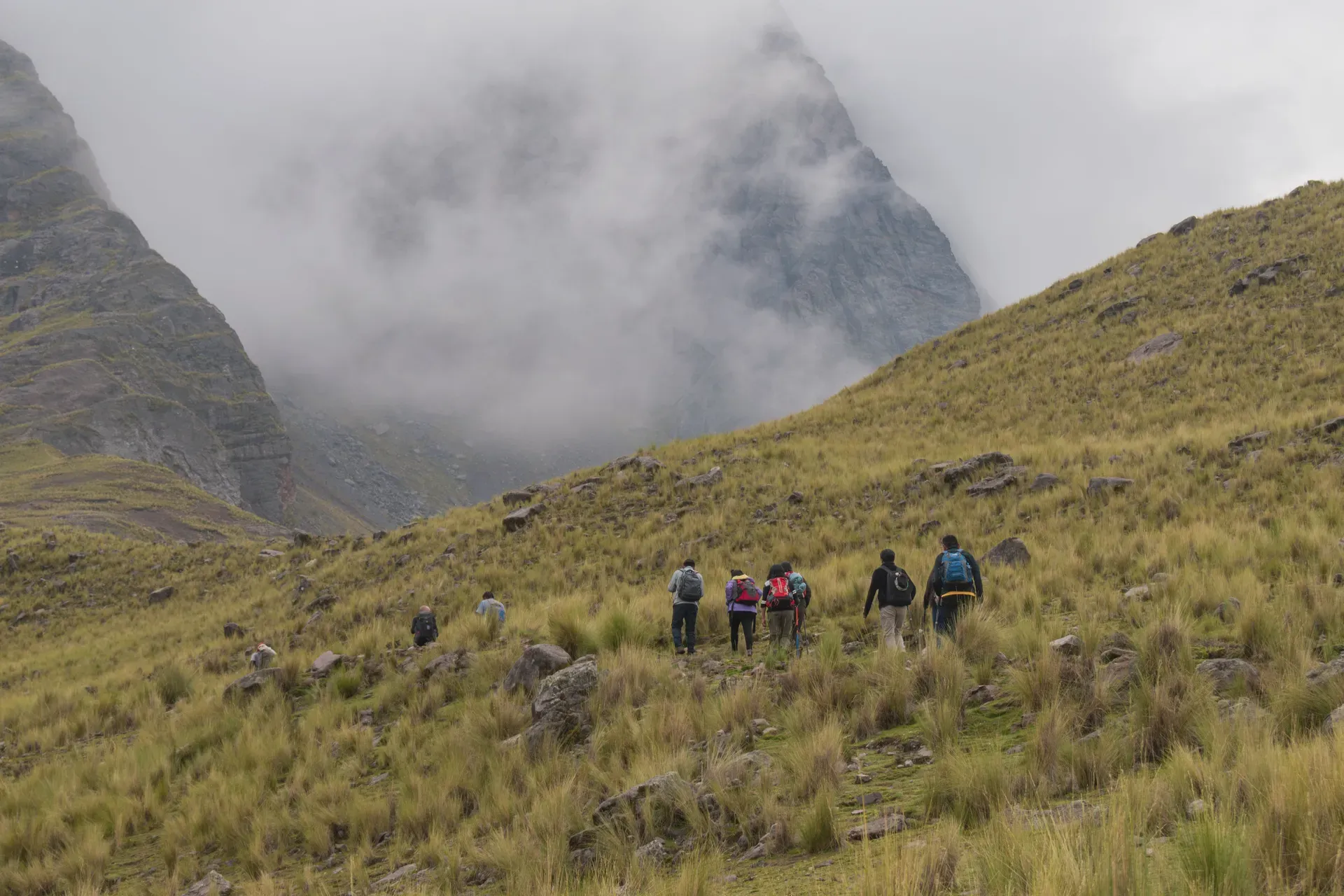
The Salkantay Trek covers 74 kilometers of rugged Andean terrain, connecting high-altitude glaciers to tropical cloud forests. Hikers cross a 4,630-meter mountain pass over five days to reach the Machu Picchu citadel.
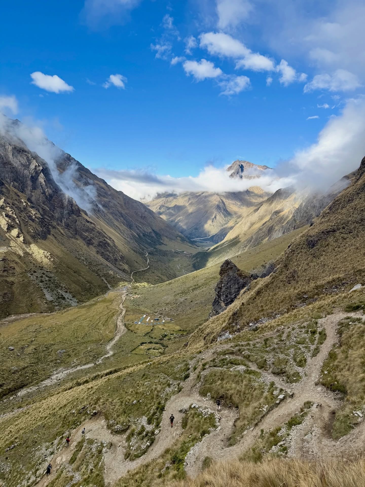
Hikers cover 74 kilometers of shifting ecosystems on the Salkantay Trek, dropping from freezing alpine zones to humid subtropical jungles. The route bypasses the heavily regulated Inca Trail, substituting stone steps for dirt paths carved into the Vilcabamba mountain range. Trekkers start at 3,850 meters in the village of Soraypampa and push toward the Salkantay Pass at 4,630 meters. Glacial winds hit your face as you stand directly beneath the massive ice walls of Salkantay Mountain, the 12th-highest peak in Peru. The mountain's prominence of 2,540 meters makes it a towering landmark visible for miles.
The trail requires five days of sustained physical effort. Up to 22 kilometers a day. Mudslides frequently wipe out sections of the path between November and April, forcing hikers to turn back or reroute. During the dry season from May to October, clear skies expose the sharp contrast between the white peaks and the deep green valleys below. Temperatures fluctuate wildly, dropping below freezing at night and climbing to 25 degrees Celsius in the jungle. The journey begins with a 100-kilometer drive from Cusco to the trailhead. Travelers take a shared colectivo to Mollepata for 20 soles, departing as early as 4:00 AM, followed by an 80-soles taxi ride to Challacancha. The lack of oxygen at these elevations causes severe headaches and nausea for those who fail to acclimate.
Trekkers finish the route by walking 10 kilometers along the flat railway tracks from Hidroelectrica to Aguas Calientes. The Urubamba River rushes alongside the path, flanked by towering cliffs and dense vegetation. You do not need a permit to walk the Salkantay route, but you must secure a 152-soles entrance ticket to Machu Picchu months in advance. The trek demands careful logistical planning, as there are no ATMs along the trail until the final town. You must carry at least 1,200 soles in cash to pay for campsites, hot springs, and emergency transport.
Inca engineers carved the original trails through the Vilcabamba range to connect their highland capital with the lowland Amazon. These paths facilitated trade, moving dried meats and potatoes down to the jungle while bringing back coca leaves, feathers, and medicinal plants. Messengers known as chasquis ran these routes to relay information across the empire. The trail system bypassed the main ceremonial centers, focusing instead on utility and direct access through the rugged terrain. The route functioned as a vital artery for the empire, allowing rapid troop movement and resource distribution across harsh geographical barriers.
Salkantay Mountain remained unclimbed by modern mountaineers until the mid-20th century. A joint French-American expedition successfully reached the 6,271-meter summit on August 4, 1952. Fred D. Ayres, David Michael Jr., W. V. Graham Matthews, George Irving Bell, Claude Kogan, and M. Bernard Pierre navigated treacherous ice falls and deep crevasses to claim the first ascent. The team relied heavily on local porters to carry heavy canvas tents and rudimentary climbing gear to the base camp at 4,500 meters. Decades later, in 1985, a combined American, Swiss, and Peruvian team recorded five successful summits in a single season, proving the viability of new approach routes.
The mountain's geography shifted violently in the late 2010s. A massive avalanche wiped out the classic southern climbing route around 2018, permanently altering the approach for mountaineers. Millions of tons of ice and rock crashed into the valley below, reshaping the drainage basins. The trekking route below the peak adapted to these geological shifts, with local communities building new campsites and suspension bridges to safely route hikers around unstable scree fields.
Today, the trail operates as an open-access route managed largely by the communities along the path. Independent hikers and guided groups share the dirt tracks, relying on local farms for provisions. The Peruvian government requires no permits for the trek itself, leaving the route vulnerable to overcrowding during the peak July season. Landslides remain a constant threat during the rainy months, occasionally severing the only road access back to Cusco. Hikers must constantly monitor weather reports, as heavy rain can trap groups between flooded river crossings for days.
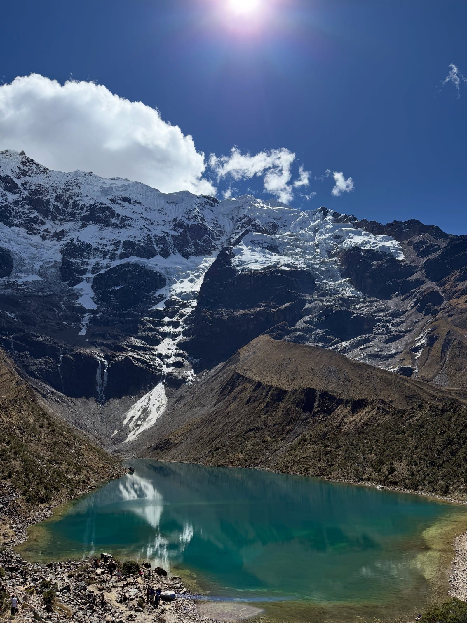
The Salkantay Trek crosses three distinct climate zones over 74 kilometers. Hikers start in the high Andean puna, characterized by sparse yellow ichu grass and rocky soil. The trail climbs sharply over loose scree to the Salkantay Pass at 4,630 meters. Here, the temperature routinely drops below freezing, and oxygen levels fall to roughly 60 percent of what they are at sea level. The 6,271-meter peak of Salkantay Mountain dominates the skyline, featuring hanging glaciers and sheer granite faces that drop thousands of feet into the valley below. The geological composition consists primarily of granite and metamorphic rock. Trekkers also pass Humantay Lake, a turquoise glacial lagoon sitting at 4,200 meters, fed directly by the melting ice of Humantay Mountain.
Descending from the pass, the topography changes rapidly. The path drops 1,500 meters in a single afternoon, transitioning into the ceja de selva, or cloud forest. Thick moss covers the tree trunks, and the air grows heavy with humidity. Trekkers walk through dense vegetation, passing organic coffee plantations, banana trees, and wild orchids. The dirt trail frequently turns to deep mud in this section, requiring waterproof boots with aggressive tread to maintain traction on the steep downhill grades. Hikers navigate narrow paths cut into the sides of steep ravines, where a single misstep can lead to a severe fall.
The final stretch flattens out entirely. Ten kilometers of flat walking. Hikers follow the active PeruRail train tracks from the Hidroelectrica station to Aguas Calientes. The route cuts through a deep river gorge. The Urubamba River churns over massive boulders just meters from the tracks, while 500-meter vertical cliffs covered in jungle canopy rise on both sides. Biting mosquitos swarm in this low-elevation zone, making high-DEET insect repellent a strict necessity. Along the way, hikers stop at the Santa Teresa hot springs, paying a 5 USD entry fee to soak tired muscles in natural thermal pools surrounded by the jungle.
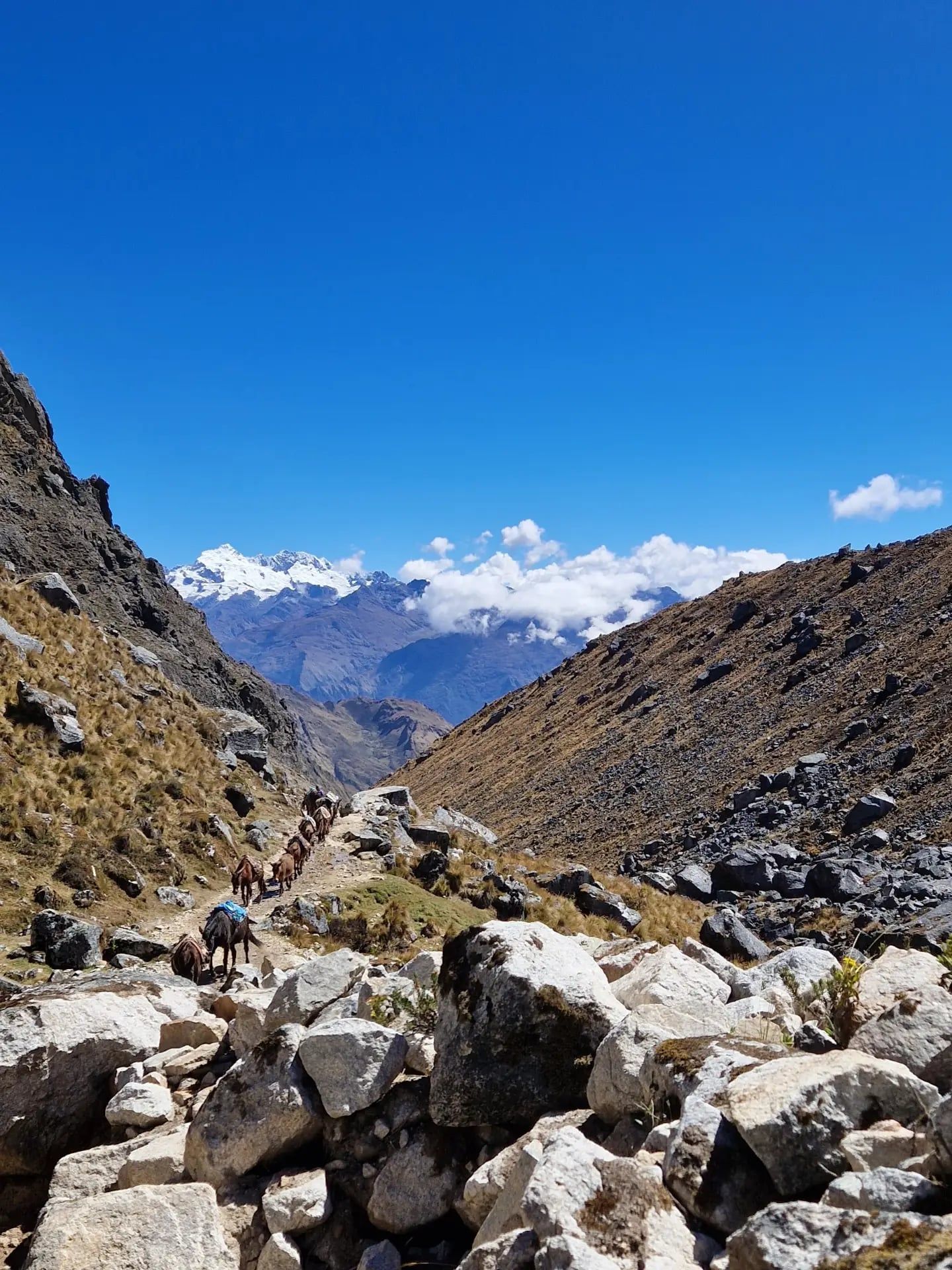
Andean communities revere Salkantay Mountain as an 'Apu,' a sacred protector deity. The name translates roughly to 'Savage Mountain' in Quechua, reflecting its violent weather patterns and frequent avalanches. Local farmers believe the mountain controls the rain and fertility of the surrounding valleys. They perform regular offerings, known as despachos, burying coca leaves, animal fat, and grains to appease the peak and ensure a successful harvest. Trekkers often see small stone cairns, called apachetas, built by locals and passing hikers at the highest points of the trail to ask the mountain for safe passage.
The trek passes directly through remote agricultural villages like Collpapampa and Lucmabamba. Residents here maintain traditional farming methods, cultivating coffee and cacao on steep terraced plots. Hikers interact directly with these communities, purchasing water and snacks from small wooden kiosks built outside family homes. This direct economic exchange bypasses large tour operators, funneling cash straight into the local economy. Many families have converted their land into private campsites, featuring glass cabanas and sky domes that allow guests to sleep under the unpolluted Andean night sky.
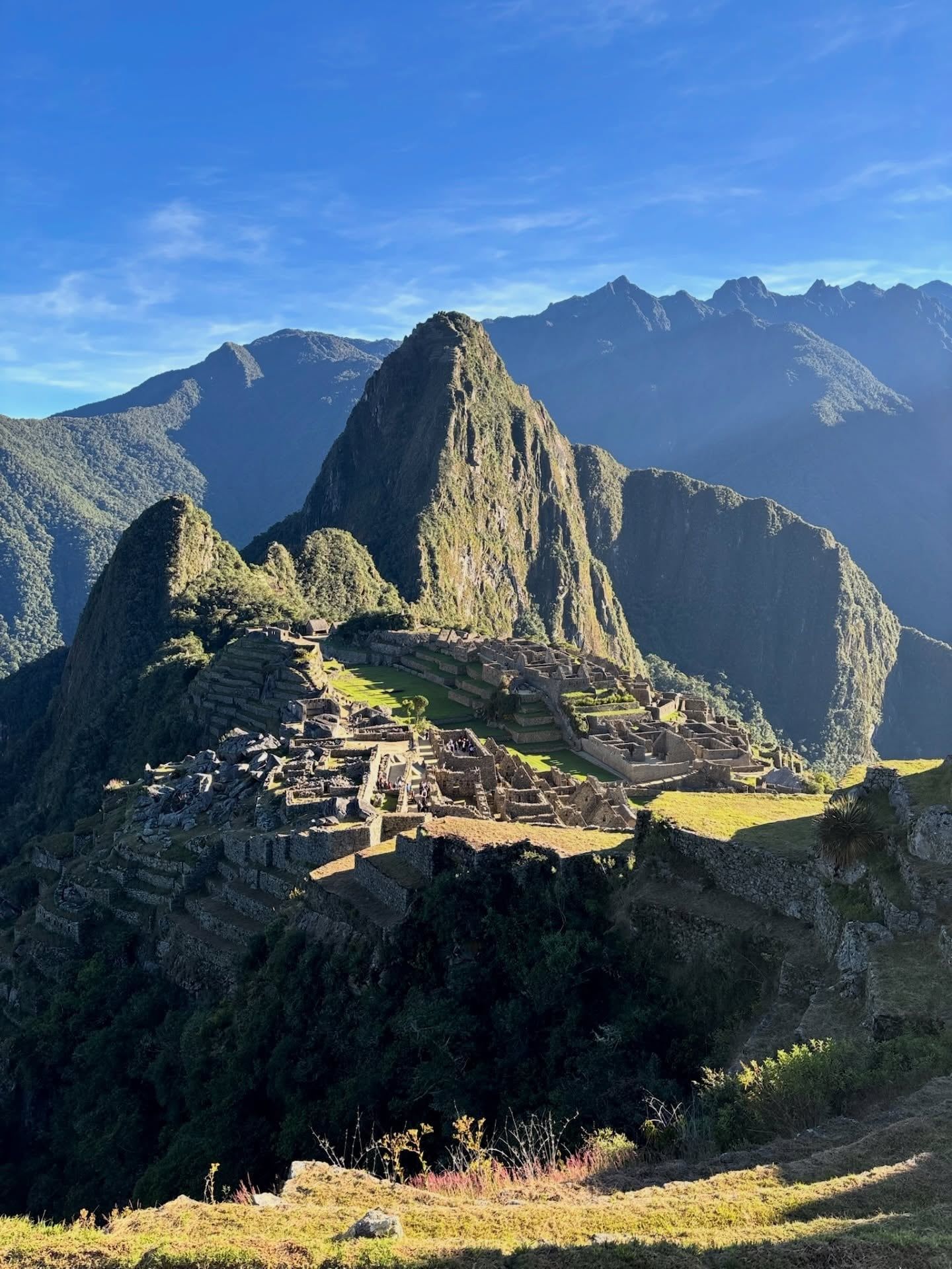
Ancient ruins dot the landscape. No manicured lawns. No massive crowds. The Llactapata archaeological site sits on a high ridge overlooking the Santa Teresa valley. Hikers who make the steep climb to these ruins get a direct line of sight to Machu Picchu across the gorge. The site remains largely unexcavated, covered in thick vines and tree roots. Exploring these ruins provides a quiet alternative to the main citadel. Visitors must respect local laws, as altering or damaging any Inca construction carries severe legal penalties.
Salkantay stands at 6,271 meters above sea level, making it the 12th-highest mountain in Peru.
A massive avalanche around 2018 completely wiped out the classic southern climbing route to the summit.
During the winter solstice, the Southern Cross constellation rises directly above Salkantay Mountain.
The trail drops 1,500 meters in elevation during a single afternoon descent into the cloud forest.
Drones are strictly prohibited at Humantay Lake and Machu Picchu to protect the environment and wildlife.
Hikers walk directly through working organic coffee and cacao plantations in the lower jungle sections.
The final 10 kilometers of the trek require walking alongside active train tracks from Hidroelectrica.
No, hikers do not require a special permit to walk the Salkantay route. You must, however, purchase entrance tickets for Machu Picchu months in advance, which cost 152 soles for foreign adults.
The classic route covers 74 kilometers over five days. The longest single day of hiking spans 22 kilometers from Soraypampa to Collpapampa.
The highest point is the Salkantay Pass at 4,630 meters (15,190 feet). Trekkers reach this altitude on the second day before descending into the jungle.
Yes, independent hikers can navigate the well-signposted trail without a guide. Local guesthouses and campsites along the route sell food and provide lodging.
A standard five-day group tour costs between $550 and $695 USD per person. Luxury tours with private domes and hot showers can exceed $1,095 USD.
Many tour agencies ban children under 14 years old due to the extreme physical demands. The high altitude and long daily distances pose severe risks for young hikers.
Bathrooms remain basic and rustic during the first two days in the high mountains. Lower elevation camps offer better facilities, including hot showers and private toilets.
The risk is high, as the trail starts at 3,850 meters and climbs to 4,630 meters. Hikers must spend at least two days acclimating in Cusco before starting the trek.
You can take a 1.5-hour train ride from Aguas Calientes to Ollantaytambo for about $70 USD, followed by a bus to Cusco. A cheaper $5 USD bus runs from Hidroelectrica, but the road is narrow and poorly maintained.
You need sturdy, waterproof hiking boots with aggressive tread. The trail features loose scree in the high mountains and deep mud in the jungle sections.
Browse verified tours with free cancellation and instant confirmation.
Find Tours